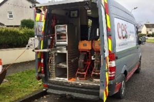
GPS Mapping is essential when carrying construction works on a building or site to have detailed drawings of the current drainage layout. We at CES Environmental Services provide our client with detailed drawings of all foul and storm lines, manholes, gullies with GPS coordinates.
GPS-Mapping Process
Our highly experienced Engineers use the most up to-date CCTV cameras with Wincan V8 and Sonde Transmitter to locate the drainage network. We also use a Trimble TDC 100 to provide accurate GPS co-ordinates – this will also provide photos of each point. Our Engineer then produces a drawing, report and DVD footage of the drains.
Our finished GPS-mapping report will also highlight any issues or faults in the drainage network. This will ensure that our client can move forward with full knowledge of their drainage network and its condition.

Other Services

CCTV Drain and Sewer surveying

Drain and Sewer relining

